Millions of Points and Not a Single Line: How Geospatial Data Processing Turns Scans into Engineering Documentation
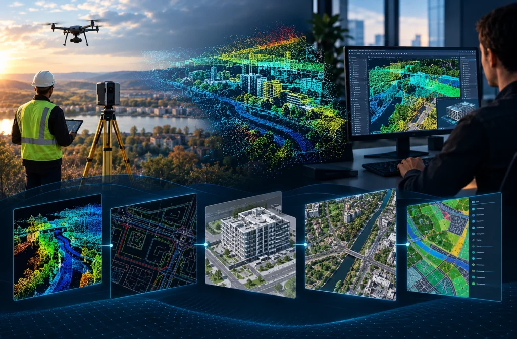
A drone flew over a site in twenty minutes. A laser scanner surveyed an intersection in one morning. The surveyors left the site satisfied: they had collected the data. But the client received neither a map nor a drawing. Instead, they received a file several gigabytes in size, with millions of points floating in space that did not mean much yet.
A major but often overlooked stage lies between field data and a document an engineer can use: geospatial data processing. This is where point clouds become topographic plans, aerial photographs become orthophotos, and archives of outdated drawings become organized GIS databases. Let’s explore how this work operates, which tools specialists use, and why it offers one of the most remote-work-friendly career paths in the AEC industry for engineers, GIS specialists, and CAD professionals.
The Field Collects Data, the Office Transforms It
Modern surveying technologies have become fast and accessible. But the faster teams collect data, the more files accumulate while they wait for processing. Field surveys take hours, while office-based processing of the same data can take weeks.
As a result, many projects now divide the process into two parts. Field crews capture reality: they scan, fly drones, and take measurements. Office specialists turn raw data into deliverables for designers, road engineers, and utility network operators.
Here is an important detail: the second part does not require a presence on site. Specialists need a powerful computer, access to the data, and the right software. This creates demand for remote professionals who can join projects from anywhere in the world.
Five Transformations in Geospatial Data Processing
1. Point Cloud → Drawings (Scan-to-CAD)
Laser scanning produces an extremely accurate but “silent” model. Every point has coordinates, but the software does not know that one group of points represents a curb while another represents a manhole. The specialist must identify these objects and convert them into lines, symbols, and drawing layers in AutoCAD or Civil 3D, following the client’s drafting standards.
2. Point Cloud → BIM Model (Scan-to-BIM)
For building renovation and reconstruction, specialists convert point clouds into Revit models containing walls, floors, windows, and building systems. This provides a basis for design when current documentation does not exist or differs significantly from the actual building.
3. Aerial Images → Orthophotos and Terrain Models
Photogrammetry turns hundreds of drone images into orthophotos, digital elevation models (DEMs), and dense point clouds. Specialists use software such as Agisoft Metashape for this work. They also need to understand how image accuracy affects the accuracy of the final result.
4. Different Formats → One System
Data arrives in Shapefile, DWG, GeoJSON, KML, LAS, and other formats. It often uses different coordinate reference systems. File conversion, coordinate transformation, and standardizing attribute schemas may sound routine, but errors often occur at this stage. These errors can then spread throughout the project.
5. Data Layers → Analysis
Once specialists organize the data, they can use it for analysis. They can overlay utility networks on cadastral maps, identify route conflicts, and assess land suitability. GIS analysts use tools such as ArcGIS Pro and QGIS for this work. Their output is not simply a drawing but an answer to an engineering or management question.
The Invisible but Most Important Stage: Quality Control
A good-looking map with topology errors can be more harmful than no map at all because people trust it. That is why professional geospatial data processing always ends with quality checks. Specialists verify that polygons are closed, required attributes are complete, coordinates match control points, and the data structure meets the client’s standards.
Standards deserve special attention. Different countries have their own requirements for spatial data. Examples include the European INSPIRE Directive and the UK’s National Underground Asset Register (NUAR). Knowledge of these requirements gives specialists a significant advantage when they work on international projects.
AI Is Already Here: Automated Object Recognition
One of the most repetitive tasks in data processing involves manually finding hundreds of similar objects in a point cloud: light poles, manholes, drainage inlets, and road signs. Machine learning is now helping automate this work.
For example, GIS J.O.T has developed VisionSpot AI. According to the company, the tool automatically identifies topographic features in point clouds, including light poles, manholes, drainage inlets, and road signs, for further digitization. The company also offers plugins that automate work in AutoCAD and Civil 3D.
Does this mean the profession will disappear? Quite the opposite. As in other AEC fields, automation handles repetitive tasks while people make decisions. Specialists check results, resolve ambiguous cases, and adapt rules to each project’s standards. Professionals who understand both data and algorithms have greater market value than those who only trace points manually.
Which Tools Should You Know?
The software stack depends on the specialization, but job postings often mention these tools:
- ArcGIS Pro and QGIS — spatial analysis, cartography, and spatial database management.
- AutoCAD and Civil 3D — drafting, topographic plans, and road corridors.
- Autodesk ReCap and Leica Cyclone 3DR — point cloud processing.
- Revit — building models for Scan-to-BIM workflows.
- Agisoft Metashape — photogrammetry.
- FME and PostGIS — data conversion and storage.
You do not need to master everything at once. To get started, learn one GIS package and one CAD tool well. Understand coordinate reference systems and data formats. You can develop the rest through practical experience on real projects.
Who Can Enter This Field?
Geospatial data processing offers a natural career path for several groups of professionals:
- Surveyors and land management specialists who want to move from fieldwork to office-based work or join international projects remotely.
- CAD drafters and design engineers who want to work with real survey data.
- GIS specialists who want to deepen their knowledge of 3D data and point clouds.
- BIM/Revit specialists who can use Scan-to-BIM to work on renovation projects and existing buildings.
- Students in surveying, geography, and civil engineering who want a practical field with a clear set of skills to develop.
Frequently Asked Questions
What is geospatial data processing in simple terms?
It means turning raw survey data, such as point clouds, aerial images, geodetic measurements, and old drawings, into organized maps, drawings, models, and databases that engineers can use.
Do you need to visit the site?
Not for office-based processing. Separate field crews carry out the surveys, while office specialists work with the data they collect. This makes the work well suited to remote arrangements.
What are Scan-to-CAD and Scan-to-BIM?
Scan-to-CAD means creating drawings from a point cloud captured by laser scanning. Scan-to-BIM means using the same data to create a building information model, usually in Revit.
Will AI replace data processing specialists?
AI handles repetitive object recognition, but people still check the results, resolve ambiguous cases, and adapt workflows to project standards.
Where should you start if you have no GIS experience?
Learn one GIS package, such as the free QGIS software. Get familiar with coordinate reference systems and data formats, then try processing an open dataset. Courses, internships, and your first projects can help you build further experience.
Want to work with geospatial data, point clouds, and international projects remotely? Explore current vacancies for GIS and CAD specialists at join-jot.com, or submit your CV.