INTERGEO 2026: Three Days That Made the Future of Engineering Feel Much Closer
What happens when you bring together surveyors, GIS specialists, engineers, developers, and technology companies from around the world in one place? You get INTERGEO. Add AI, LiDAR, point clouds, digital twins, and dozens of live demonstrations, and three days go by very quickly.
From September 15 to 17, the J.O.T Solutions team took part in INTERGEO 2026 in Munich, one of the major international events in surveying and geospatial technologies. This year’s exhibition was especially packed, from GNSS, LiDAR, and aerial surveying to 3D visualization, GIS, mobile mapping, BIM/AEC workflows, and Reality Capturing.
But for us, INTERGEO was not only a chance to see where the industry is going.
We came to show what we are working on ourselves.
VisionSpot: When AI Takes Over Routine Work
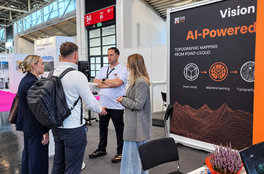
At the J.O.T Solutions booth, we presented VisionSpot, our AI-powered solution for automating LiDAR data processing and creating topographic information.
Instead of spending hours manually searching for and digitizing objects, the system uses machine learning to recognize them and turn raw data into structured information that teams can use in their workflows. This includes point objects such as lights, manholes, and others.
And this is where the most interesting part of INTERGEO began.
People came to the demonstration, asked questions, shared their own processes, and tried to understand: what can we automate today?
During the first two days, the J.O.T booth was full of meetings and conversations. The strong interest in live VisionSpot demonstrations became one of the main results of our participation in the exhibition.
The Most Valuable Part of INTERGEO Was Not Even the Technology
Of course, there was a lot to see.
Laser scanning, mobile mapping, Reality Capturing, Digital Twins, AI solutions, new equipment, and geospatial data automation – some technologies that seemed experimental only a few years ago now appear as real working tools.
One trend stood out in particular: AI is gradually moving from an impressive presentation to a practical tool that removes manual operations and speeds up an engineer’s work.
But after INTERGEO, people are what we remember most.
Three days of direct communication with engineers, potential partners, clients, developers, and representatives of the geospatial industry gave us something that dozens of online meetings cannot easily provide: the chance to show a technology immediately, hear people’s reactions, discuss a real task, and get a new idea in the middle of a conversation.
These meetings often become the starting point for future projects.
What Did We Bring Back from Munich?
Not only photos from the booth. 🙂
We came back with new contacts, ideas, professional connections, and, most importantly, direct feedback from people who work with geospatial data every day.
INTERGEO 2026 showed us one important thing once again: the future of engineering is not about replacing engineers with technology.
It is about removing as much routine work as possible and giving engineers more time for work that truly requires experience, knowledge, and engineering thinking.
This is the direction we are taking at J.O.T Solutions.
And after three days in Munich, we have even more ideas about where to go next.
INTERGEO 2026 is over. The work on what we saw, heard, and came up with there is only beginning. 🚀